

Nature Photography
Slideshow by M.Bukhari
Landscape of Pakistan and AJK
9687 views since March 22, 2009.
Get a link button for this slideshow »
Make and share your own slideshow »
1 of 36
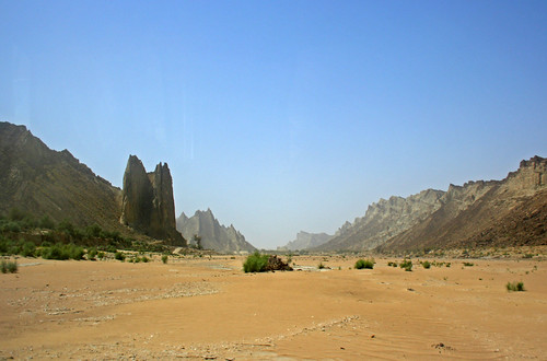
Amazing Landscape
Hingole National Park
Photo by NotMicroButSoft (CJ Restored Finally - Congrats)
2 of 36
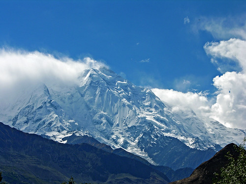
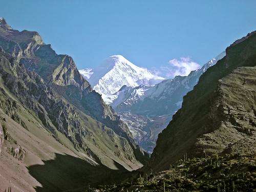
Hide-N-Seek
Rakaposhi with BADIL BARD SOSH.
Explored @ # 289 on 21 Dec 08
Photo by NotMicroButSoft (CJ Restored Finally - Congrats)
3 of 36
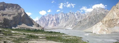
Passu Cones
A panorama of Passu village along Hunza River, with Passu Cones in the background.
Photo by NotMicroButSoft (CJ Restored Finally - Congrats)
4 of 36
Pearl Valley
Rawalakot - AJK - also called the "Pearl Valleys" for its un-parallel and heavenly beauty.
Photo by NotMicroButSoft (CJ Restored Finally - Congrats)
5 of 36
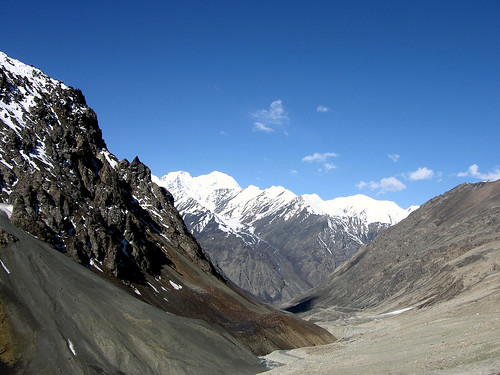
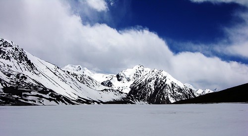
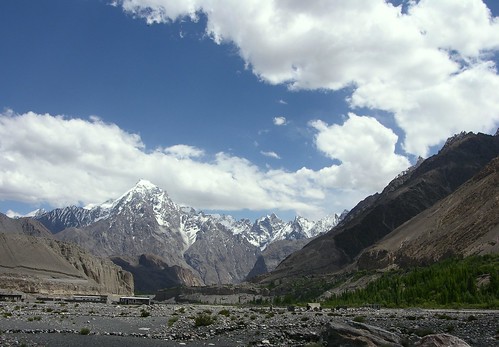
The Roof of the World
Khunjerab Pass (el. 4693 m./15,397 ft.) is a high mountain pass on the northern border of Pakistan-administered Kashmir (Northern Areas of Pakistan) with the People's Republic of China. The name comes from the Wakhi for Blood Valley.
It is the highest paved border crossing in the world. It is also the highest point on the Karakoram Highway. This section of the road was completed in 1982, superseding two other passes (the Mintaka Pass and Kilik Pass - both unpaved) previously used by travellers.
The long flat pass is often snow-covered during the winter season and is closed from October 15 to May 1. There is excellent grazing on the Chinese side of the pass, and domesticated yaks and dzu (a cross between yaks and cows) may be seen from the road. On the Pakistani side, the highway travels about 50 km across the extensive Khunjerab National Park before reaching the security outpost of Dih. From there, it is another 35 km to the customs and immigration post at Sust.
Since June 1, 2006, there has been a daily bus service across the boundary from Gilgit, Pakistan to Kashghar, China and road widening work has begun on 600 kilometers of the highway.
In 2007, consultants were engaged to investigate the construction of a railway through this pass to connect China with Pakistan.
Explored: #466 on 25 Oct 07
Photo by NotMicroButSoft (CJ Restored Finally - Congrats)
6 of 36
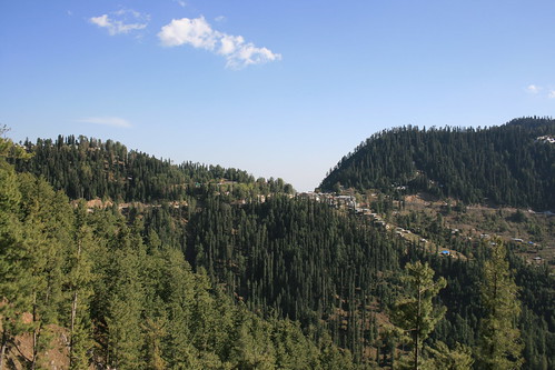
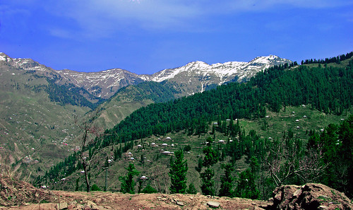
Galiyat
A view of Donga Gali from a place near to Nathia Gali, NWFP.
Photo by NotMicroButSoft (CJ Restored Finally - Congrats)
7 of 36
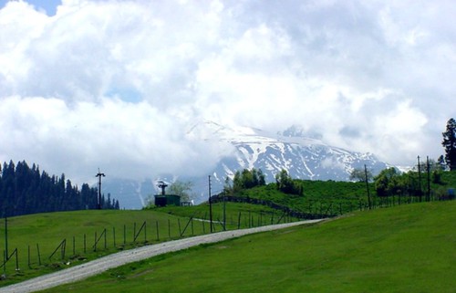
The height of delight
Gulmarg ? A hill resort with magical meadows and mountains. The word "Gulmarg" literally means "the meadow of flowers". The snow-clad peaks and the lovely landscapes of Gulmarg make the most favourite background spot for several Bollywood ventures.
The slopes in Gulmarg varying between 8,700 and 10,500 feet make the ski runs the highest in the region. It is noteworthy that Gulmarg is the only heli-skiing resort in Asia. Even the amateurs can enjoy with the ski lifts and the chair lifts. Gulmarg also boasts of a gorgeous green golf course that happens to be the world's highest too.
Located in the Baramulla district of Jammu and Kashmir, and at an amazing altitude of 2,730 meters above sea level, Gulmarg is 57 km southwest from the capital city of Srinagar and is close to the Line of Control.
The gorgeous hill resort of Gulmarg is dotted with sites of interest for the tourists. Khilanmarg is the spot for skiing in winters. One can enjoy the views of the Kashmir valley and the Himalayan range from Khilanmarg. Then there is the Alpather Lake, a picturesque alpine lake that remains frozen until late June. From Khilanmarg the lake lies across the Apharwat peak
Gulmarge is also known for the famous shrine of Baba Reshi ? a Muslim mystic saint
This picture is from one of my old collections (A Scanned Image, of course).
Photo by NotMicroButSoft (CJ Restored Finally - Congrats)
8 of 36
Queen of Mountains
Rakaposhi - hiding in clouds.
Photo by NotMicroButSoft (CJ Restored Finally - Congrats)
9 of 36
Diran Peak
The peak is called Minapin as well as Diran. It is situated in Rakaposhi and Haramosh mountain region near the Minapin, Hinarchi and Baultar glaciers and is easily accessible because of the Karakoram Highway. There is confusion about its height but now all agree that it is 7,273m. Height, it is one of the fascinating peaks that dominates the Gilgit valley and adds special color to its otherwise rugged beauty.
A three-member Austrian expedition, which included Rainer Goschl, Rudolph Pischinger and Hanns Schell, decided to try its luck on Minapin in 1968 after being refused permission to climb Kampire Dior peak. It set up camp I at 4,800m. Big crevasses, inclement weather and deep snow is recorded between camps I and II. It was from camp Ill that the party was able to reach the peak which it termed as a ?big summit plateau?. The 1958-British expedition to Diran peak failed to climb it from north-west face because its leader, E.G.C. Warr and a member, F.C. Hoyte, were struck by storm and disappeared when only 300 feet from the summit. In 1959, a German Karakoram expedition, under the leadership of Hans Jochen Schneider, wanted to carry out a geological and geophysical survey in Batura glacier area. It was refused permission. Consequently, it turned its attention to Minapin - Rakaposhi area. On the 9th June, one member, Erwin Stocker, and one porter reached an 18,000-foot-col situated to the north of Minapin. Subsequently, the party could reach a place which was less than one thousand feet short of north-west face of the summit. In 1964, an Austrian expedition from Salzburg attempted to climb the peak from the north-west face but was unsuccessful because of bad weather and danger of avalanches. The party had only three climbers.In 1965, a Japanese expedition of Kyoto Mountaineering Federation attempted to climb the peak. Earlier, in 1963 two of its members had reconnoitered the peak. The party was only 250ft from the summit on north-west face when it had to abandon the climb because of ?strong winds and whirring snow.?
www.adventureguide.com.pk/htmls/mountaineering_5.htm
Diran Peak as seen from Ganesh, Hunza Valley.
Photo by NotMicroButSoft (CJ Restored Finally - Congrats)
10 of 36
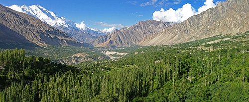
Queen of the Valleys - Queen of the Peaks
Hunza Valley, and Rakaposhi
A shot taken from Karimabad, Hunza.
Explored @ # 431 on 2 Jan 09
Photo by NotMicroButSoft (CJ Restored Finally - Congrats)
11 of 36
Sunrise Over PirSohawa Road
A view of Murree mountains (in the background)
Shot taken from Pir sohawa Road, Islamabad.
Photo by NotMicroButSoft (CJ Restored Finally - Congrats)
12 of 36
Shamsa Barri
Famous Shamsa Barri Top (some 13,000 plus feet ASL) in Leepa Valley of AJK as seen from Murree/Galliyat.
The snowclad area of the mountain is in indian held kashmir, while the remaing part and the valley floor are in AJK.
Explored @#357 on 29 Oct 08
Photo by NotMicroButSoft (CJ Restored Finally - Congrats)
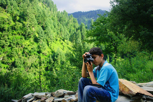
13 of 36
SWEETO
AsharDaGr8 - taking a shot in Reji near Hillan, Tehsil Haveli, District Bagh AJK. He shot some very good snaps there.
He has become a very good trekker. He went to Kaghan Valley with Pakistan Adventure Foundation on their Nature Conservation of Mountains campaign. It was a 10 days trip to Paya Naran, SaifulMaluk, and Lalazar. There were about 70 children of age between 11-14 yrs from all over the country. They trekked from shogran to Paya, and then from Naran to Lalazar, and Saifaul Maluk. He fully enjoyed it.
In this trip to AJK, he travelled 16 km in one day with me and it includes 8 km of steep climbing and 8 km of descend. And still he was fresh upon return. I love you Ashu for your passion.
www.flickr.com/photos/ashar/
Photo by NotMicroButSoft (CJ Restored Finally - Congrats)
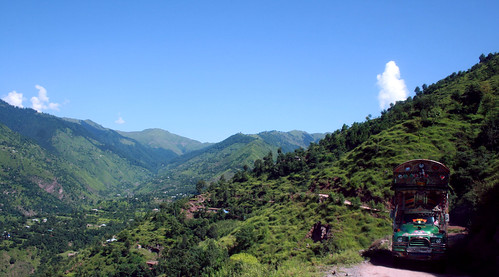
14 of 36
Pahardoun Ka Shehzada
Translation: KING OF MOUNTAINS
This is what was written on this truck.
A view of Hallan, Aliabad, and Hajipir Pass, from Soli-Kahuta road, Haveli, AJK
Photo by NotMicroButSoft (CJ Restored Finally - Congrats)
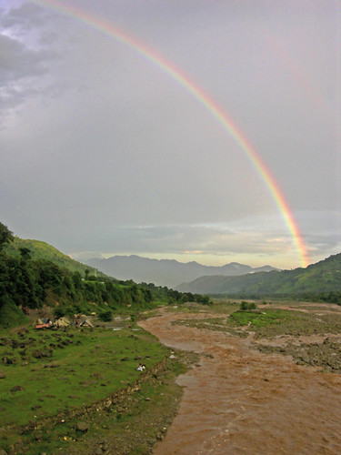
15 of 36
DHANAK (Rainbow)
Saw ths beautiful rainbow while crossing bridge over Abbasspur Rangard (Nullah).
Explored at #494 on 20 July 2008
Photo by NotMicroButSoft (CJ Restored Finally - Congrats)
16 of 36
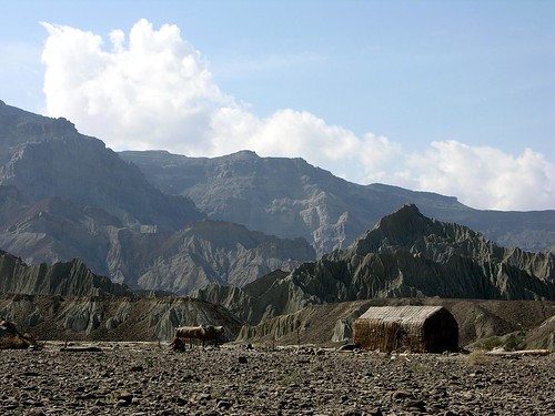
Hinglaj Mandir AKA Nani Mandir
HINGLAJ MANDIR/NANI MANDIR
Geographical Location
Hinglaj Mandir or Nani Mandir is an important Hindu pilgrimage place and situated in Hingol National Park, Balochistan, Pakistan. It is near the peak of one of the mountains of the Makran range. It is approximately 120 km from the Indus River Delta and 20 km from the Arabian Sea. The area is extremely arid and the pilgrimage also called 'Nani ki Haj' by local Muslims takes place before summer. The pilgrimage starts at a place near the Hao river which is 10 km from Karachi.
Mythological Origin
When Lord Vishnu cut up the body of Sati into 51 pieces so that Lord Shiva would calm down and stop his Tandava, the pieces were scattered over various places in the Indian subcontinent. It is said that the head of Sati fell at Hingula or Hinglaj and is thus considered the most important of the 51 Shakti Peeths. At each of the Peeths, Bhairaba ( a manifestation of Shiva) accompanies the relics. The Bhariaba at Hinglaj is called Bhimalochana. The Sanskrit texts mention the part as 'Brahmadreya' or vital essence.
In the Ramayana, after slaying Ravana, Lord Ram came to Hinglaj to atone for his sin of 'Brahmhatya' (killing a Brahmin). Ravana was a Brahmin and a great devotee of Lord Shiva and Durga. Lord Ram meditated at Hinglaj as it was a very important shrine.
The mantra or incantation for Devi Hinglaj is attributed to Saint Dadhichi, an important saint in Hindu mythology. The mantra is :
OM HINGULE PARAM HINGULE AMRUTRUPINI TANU SHAKTI MANAH SHIVE SHREE HINGULAI NAMAH SWAHA
Translation : "Oh Hingula Devi, she who holds nectar in her self and is power incarnate. She who is one with Lord Shiva, to her we pay our respects and make this offering (swaha)"
The name of Hinglaj lends itself to the Hingol river, the largest in Balochistan and the Hingol National Park which at 6,200 square kilometers is the largest in Pakistan.
Since it is located in a desert which is called Maru in Sanskrit, the shrine is referred in holy texts as "Marutirtha Hinglaj" which means Hinglaj, the
Shrine of the desert.
The Makran Coastal Highway linking Quetta and Gwadar passes through Balochistan. It was built by China and follows the same path which Alexander took when he ended his campaign. The highway has made the pilgrimage and visiting the shrine very convenient.
Social Significance
Despite the partition and the increasing Islamic stance of the Pakistani Government and society, Hinglaj has survived and is in fact revered by local Muslims who call it 'Nani ki Mandir'. Muslims offer red or saffron clothes, incense, candles and a sweet preparation called 'Sirini' to the deity. The Muslims protected sites like Hinglaj which are the last vestiges of the Hindu society which once straddled the area.
Hingula means cinnabar (HgS Mercuric Sulphide). It was used in ancient India to cure snakebite and other poisonings and is still employed in traditional medicine. The Goddess Hingula is thus believed to possess powers which can cure poisoning and other diseases. The Muslim name 'Nani' is an abbreviation of the name of the ancient Goddess "Nanaia", whose Persian name is "Anahita".
The Pilgrimage
Although the road linking the port of Gwadar on the Arabian Sea with the interior has shortened the pilgrimage a lot, the ancient path followed for millennia through the Baluch desert is endowed with a unique importance. The very journey on foot is considered a penance to purify oneself before approaching the deity. An account of such a journey is given below.
The pilgrims are led by priests or caretakers of the shrine through the desert. They hold a wooden trident in their hands. The trident or Trishul is the weapon of Lord Shiva and hence is associated with the Sati too. Since they hold the trident during the trip, they are called 'Charidaars' (Those who hold the stick or Chadi). The Chadi is draped with saffron, red or pink coloured fabrics.
The priests give a saffron cloth to every pilgrim and an oath is taken that each would help the other. However they are warned not to share their personal stores of water. This act is deemed to be a sort of fast and penance necessary for the journey.
On the path to the shrine are situated wells which are guarded by the local tribesmen. Feuds over water, a scarce commodity, is common in the area. The tribesmen are offered food consisting primarily of Roti (circular flat disks of baked flour) in lieu of water.
Baba Chandrakup
An important stop during the pilgrimage is the mud volcano called 'Chandrakup' (literally 'Moon Well'). It is considered holy and is addressed as 'Baba Chandrakup' The volcano is filled with mud, instead of magma, hence the term "mud volcano". It is considered to be the abode of Babhaknath. It is one of the few sites of active volcanic activity in the Asian mainland. The mud is semi fluid and sometimes it spills over and aggregates and cools into hillocks which surround the site. There are altogether 18 mud volcanoes in the region.
Pilgrims stay up all night at the base of the volcano making Rotis which are offered to the volcano. The activity is considered to be very holy. The ingredients, flour, ghee (clarified butter), jaggery, sugar are mixed on a cloth which is held at all times at four corners by pilgrims. This is done to ensure that it never touches the ground. The prepared Rotis are covered with wood.
At daybreak, the Rotis are carried by the pilgrims and priests to the mouth of the crater. A Chadi or Wooden Trident is planted near the edge of the crater and offerings of incense and cannabis are made along with recitation of 'mantras'. The rotis are then tore up and cast into the crater.
After this ritual every pilgrim is asked to confess his sins and ask for forgiveness. Anyone who refuses or hesitates to confess to his or her sins is ostracised and abandoned by the party. After the confession, the party proceeds with the permission of 'Baba Chandrakup'.
Reaching the Shrine
The pilgrimage continues for another four to five days after leaving Chandrakup. The final stop is a small village with wooden houses. It is home to the caretakers of the shrine and Baluch tribesmen who revere the deity even though they are Muslims. Before entering the shrine, the pilgrims bathe in the Hingol (also called the Aghore) river. The shrine is situated on the mountain on the other bank of the river. The pilgrims bathe and visit the shrine in their wet clothes.
The Shrine's Mark
The shrine is recognised by a mark which resembles the sun and the moon. This mark is upon a giant boulder at the top of the hill containing the cave. It is believed that Lord Ram created this mark with the strike of his arrow after his penance ended.
The Shrine
The shrine is called 'Mahal', a word of Sanskrit origin which means palace. The natural beauty of the shrine has spawned folklore that it was constructed by demigods called 'Yakshas'. The walls and roof of the cave are encrusted with colourful stones and semi-precious veins. The floor is also multi hued.
The entrance to the cave is around 50 feet in height. At the end of the cave is the sanctum sanctorum , which houses the holy relic. It is covered by red clothes and vermilion. There are two entrances to the sanctum. One has to crawl into the sanctum, take the 'darshan' and leave through the other opening. Prasad is distributed to the pilgrims and they return after seeing the Milky Way at night.
Hingula Pithas in the Subcontinent
Although the Hingula shrine in Balochistan is considered to be a true Shakti Peetha, other shrines dedicated to the goddess exist in India and Sri Lanka. One important shrine is located 14 km from Talcher in the state of Orissa in India. King Nala of the Vidarbha region of Western India was an ardent devotee of Devi Hingula. He was approached by the King of Puri for help. In order to start cooking 'Mahaprasada' for Lord Jagannath he had to procure Devi Hingula as fire for the temple kitchen. The Goddess agreed and moved to Puri as fire.
Hinglaj in Popular Culture
Abadhut wrote a Bengali travelouge in 1955 about his trip to the shrine titled "Marutirtha Hinglaj".
A 1959 Bengali film titled "Marutirtha Hinglaj" starring Uttam Kumar, Chandrabati Debi and Pahadi Sanyal depicted the pilgrimage and the conflicts, human and spiritual on the path and at the shrine. It was directed by Bikash Roy who also played the part of Abadhut in the film.
en.wikipedia.org/wiki/Hinglaj
IT IS ALSO CORE HABITAT OF SIND IBEX
Photo by NotMicroButSoft (CJ Restored Finally - Congrats)
17 of 36
The Roof of the World
At Khunjrab Top in May 2006.
Explored: at #36 on 11 Jun 2008
Photo by NotMicroButSoft (CJ Restored Finally - Congrats)
18 of 36
Shero Dhara
A view of Shero Dhara mountain on the way from Bagh to Lasdanna
Photo by NotMicroButSoft (CJ Restored Finally - Congrats)
19 of 36
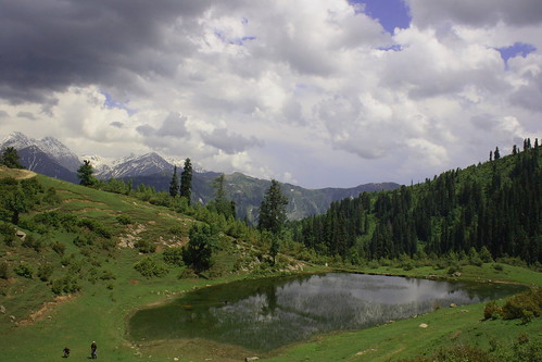
Siri
Siri lake on the way to Paya in Kaghan Valley is a beautiful place for restoring your breaths while climbing to Paya or Makra.
7 km beyond Sogran, it is a lush green picturesque spot surrounding with thick forested mountains, and snow clad peaks of himalayas.
Photo by NotMicroButSoft (CJ Restored Finally - Congrats)
20 of 36
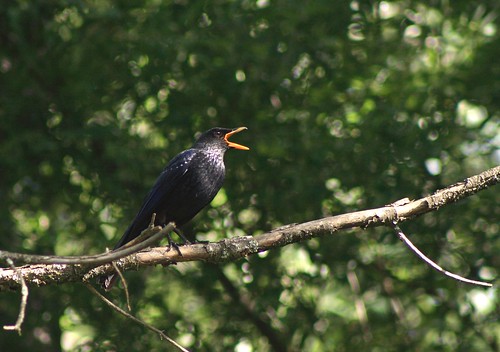
Crying with Pain of Departure
Description:
The Alpine Chough (Pyrrhocorax graculus), also called Yellow-billed Chough is a Eurasian member of the crow family, Corvidae.
It is closely related to the Red-billed Chough (Pyrrhocorax pyrrhocorax) and shares its glossy black plumage and red legs. However, the Alpine Chough's long curved bill is yellow rather than red.
Distribution:
It breeds locally in the highest mountains of southern Europe, the Alps, across central Asia and India. It is resident throughout its range. A prehistoric subspecies that lived in Europe during the last ice age was described as Pyrrhocorax graculus vetus.
Size:
It is slightly smaller at 36-39 cm length and a 65-74 cm wingspan, but has a relatively longer tail and shorter wings. It has a similar buoyant and easy flight.
Behaviour:
This bird is often gregarious and fearless. Its loud "zrrrrr" call is quite different from that of the Red-billed Chough (Laiolo et al. 2004).
Food:
Its food consists of insects in summer and berries or food scraps, especially around ski resorts, in winter. A cavity or cliff ledge is a site for the bird's nest.
Conservation Status:
LC (Least Concerned) ? according to IUCN List.
Scientific classification:
Kingdom:Animalia
Phylum:Chordata
Class: Aves
Order:Passeriformes
Family:Corvidae
Genus: Pyrrhocorax
Species:P. graculus
Binomial name: Pyrrhocorax graculus
(Linnaeus, 1766)
It was a pair of yellow-billed choughs sitting on this branch of tree at Banjosa, AJK (Pakistan). One flew away while I was trying to find out a good angle to shoot them.
Photo by NotMicroButSoft (CJ Restored Finally - Congrats)
21 of 36
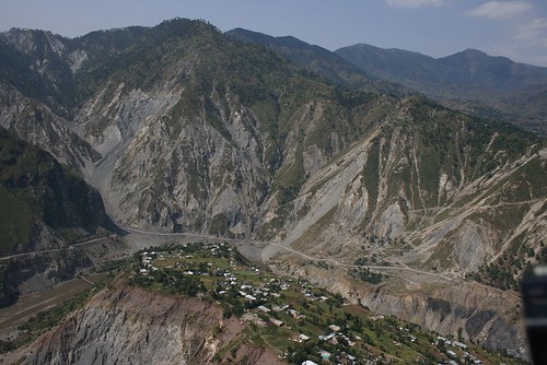
Sliced Village
Village Dhani Mai Sahiba near Kamsar, Muzaffarabad was badly damaged in October 2005 Eartquake.
This shot was taken on 23 Sep 2007 about 2 years after the quake, from helicopter. You can see the effect of the earthquake on the mountains.
Photo by NotMicroButSoft (CJ Restored Finally - Congrats)
22 of 36
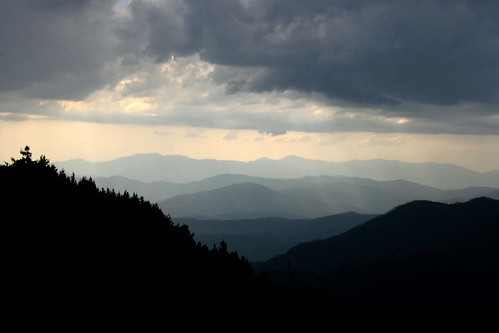
Teh - dar - Teh
Multi-layered Mountains - A dazzling view from Pir Chinasi, Muzaffarabad AJK
Photo by NotMicroButSoft (CJ Restored Finally - Congrats)
23 of 36
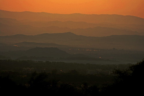
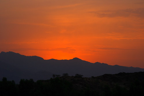
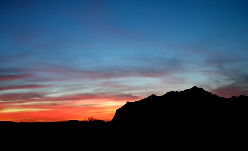
Badalta Hay Rang Asmaan Kaisay Kaisay
Post sunset shot taken from Warsak, NWFP. The mountains are in the tribal area of Khyber Agency.
Photo by NotMicroButSoft (CJ Restored Finally - Congrats)
24 of 36
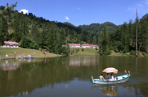
Boating in Banjosa Lake
Situated at a distance of 17 km from Rawalakot, and about 1981meter high above sea level, Banjosa Lake is a wonderful tourist spot - full of scenic beauty. Boathing and fishing can be done at Banjosa.
AJK PWD and AJK tourism departments have their rest houses here where accomodation is available on very reasonable rates ranging rom Rs.600 to Rs.1600/- per night. Reservation is done from Muzaffarabad and Rawalakot.
Photo by NotMicroButSoft (CJ Restored Finally - Congrats)
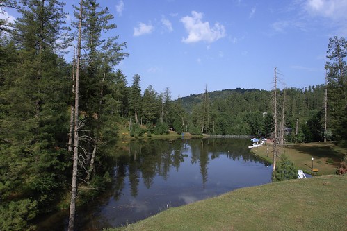
25 of 36
Serenity
Situated at a distance of 17 km from Rawalakot, and about 1981meter high above sea level, Banjosa Lake is a wonderful tourist spot - full of scenic beauty. Boathing and fishing can be done at Banjosa.
AJK PWD and AJK tourism departments have their rest houses here where accomodation is available on a very reasonable rates ranging rom Rs.600 to Rs.1600/- per night. Reservation is done from Muzaffarabad and Rawalakot.
Photo by NotMicroButSoft (CJ Restored Finally - Congrats)
26 of 36
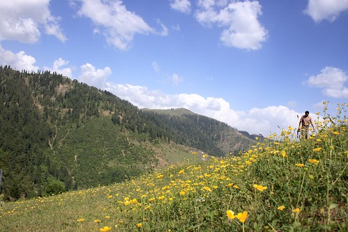
Dekha Aik Khawab to Yeh Silsilay Huway - Door Tak Nigahoun Main Hain Gul Khilay Huway
A view of Toli Pir Top in AJK.
Toli Pir is a beautiful hill station, some 30 km north-east of Rawalakot, accessible via a narrow but black-topped road. Its elevation is approximately 9,500 ft above sea level. The travel time is about one hour from Rawalakot city. The meadows on the top are lush green. The peak also offers 360 degree panoramic view of the surrounding mountains which includes the snow-capped peaks of Pir Panjal (lower Hamalayas) in Indian-held Kashmir. From the top of the mountain one can also view Abbaspur, Bagh and the Poonch river.
Shot taken during a two days visit to Banjosa and Tolipir. In the right side of the picture Yasir Nisar can been seen. Yasir also joined this tour and we had great time there. Had a lot of good birds' shots as well. I shall soon be uploading those too.
Photo by NotMicroButSoft (CJ Restored Finally - Congrats)
27 of 36
Sust
Sust or Sost is a small town in Gojal region of the Northern Areas of Pakistan. It is the last major town inside Pakistan on the Karakoram Highway before the Chinese border .
The town is an important place on the Karakoram Highway for all passenger and Cargo transport because all traffic crossing the Pakistan-China border passes through this town and the Pakistani immigration and customs departments are based here. The dryport at Sust makes it a major trade market of the area as well as an attraction for tourists.
The town of Sust is connected by the Karakoram Highway to Karimabad, Gilgit and Chilas on the South and to the Chinese cities of Tashkurgan, Upal and Kashgar in the North. The Northern Areas Transport Corporation offers passenger road service between Islamabad, Gilgit and Sost. Passenger road service between the Tashkurgan and the Pakistani cities of Sost and Gilgit also exists, and road service between Kashi and Gilgit (via Tashkurgan and Sust) starts in summer 2006. However, the border crossing between China and Pakistan at Khunjerab Pass (the highest border of the world) is open only between May 1 and October 15 of every year. During winter, the roads are blocked by snow.
In February 2007, consultants were engaged to explore the possibility of a railway link via the Khunjerab Pass. The nearest railway in Pakistan is at Havellian.
en.wikipedia.org/wiki/Sust
Photo by NotMicroButSoft (CJ Restored Finally - Congrats)
28 of 36
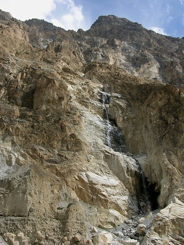
Waterfall - on the Way to Shimshal
Shimshal is a small village located in Gojal, in the Northern Areas of Pakistan. The village remained cut-off from the Tehsil Headquarter Gulmit for centuries and only in October 2003 for the first time a jeep went there after the new road from the Karakoram Highway was constructed. The famous Shimshal River comes from this area and then transforms the shape of Hunza River, which mixes with the Indus River below the capital city Gilgit. Shimshalis use numerous seasonal mountain grasslands, located several days walk from the village, to sustain herds of yaks, goats and sheep. Most of these grasslands are located within what has been declared as the Khunjerab National Park, in an area called Shimshal Pamir and its surroundings.The people of Shimshal are Wakhi and they speak the Wakhi Language. They belong to the Ismaili sect of Islam.
Shimshal Valley:
Shimshal is a farming and herding community of some 1100 inhabitants, situated at the north-eastern extreme of both the former principality of Hunza (now part of Gilgit Administrative District), and the modern state of Pakistan. The settlement occupies the upper portion of a valley of the same name, which descends west into the Hunza River valley at Passu, and which separates the Ghujerab and Hispar Mustagh ranges of the Karakoram mountain system. Shimshal?s villages are situated on a series of glacial and alluvial deposits that form a broad strip between the river's floodplain and steep mountain slopes to the south. These deposits have been terraced for several hundred years. They are irrigated by the meltwater nullahs which currently dissect them. In addition, the lowest terraces are irrigated from the river itself. The cultivated area, covering about 250 hectares, lies between 3000 and 3300 metres above sea level, at the upper limits of single crop cultivation. Shimshalis grow hardy cereals (wheat and barley), potatoes, peas and beans, apricots and apples. Small quantities of garden vegetables are also grown by some households. Shimshalis are one of the few communities remaining in Pakistan's Northern Areas that grows enough agricultural produce to feed itself.
Shimshalis complement their irrigated agriculture with extensive herding of sheep, goats, cattle and yaks. Indeed, they tend more livestock per capita than any other Hunza community, and earn much of their money from the sale of dairy produce, yaks, and yak hair carpets. This is due, in part, to the community's exclusive control of vast areas of high altitude land. Shimshal pastures cover about 2700 square kilometres of the Central Karakoram. Within that area they maintain their three dozen individual pastures, including three large and highly productive alpine areas. Also within Shimshal territory are innumerable peaks, glaciers and trekking routes, including nine peaks above 7,000 metres. Although the environmental potential for adventure tourism is high, relatively few trekkers visit this area. However, with the opening of road from Passu to Shimshal, now the influx of the international as well as the domestic tourists is gradually increasing.
Historical Background:
According to one of several popular histories of the community, the village of Shimshal was founded some four centuries ago by Mamu Singh, a Burusho from Baltit (Central Hunza), and a member of the Wazir's (prime-minister's) family. Mamu Singh was sent to Sarikol, Central Asia, as ambassador, but later fled Sarikol with his Wakhi wife Khodija, when relations with Hunza deteriorated. They were pursued into the Upper Hunza River Valley, as far as Avgarch Pasture on the slopes of Qarun Pir, where they made their home for several years before migrating into the lower reaches of the Shimshal Valley. There Mamu Singh built up his flocks of sheep and goats, and explored up the Shimshal Valley, eventually discovering a hole in the ground, whose mouth was covered with a great piece of slate. When he succeeded in removing the stone, water gushed from the hole and flowed along the remains of a channel that had been built by earlier travellers who had passed that way on their way over Pamir to Chinese Turkestan. Here in disrepair, but already constructed, was a channel from which Mamu Singh could build a village. At this time he was an elderly man, without children. However, after a miraculous visit from a holy man named Shams, Khodija gave birth to a son, by the name of Sher. Sher grew quickly to be big and strong, and an especially fine hunter. On one of his hunting trips he wandered up a side valley onto the Pamir, where he met a group of strangers, who had with them a number of horses and one small yak. Both Sher and the party of strangers claimed the Pamir as their own. Eventually they agreed to resolve the dispute with a polo game, using all Pamir as the playing field: if Sher drove the ball over Shimshal Pass toward Shuwert, he would win title to all territory from Shimshal to Raskam; if the Chinese succeeded in carrying the ball to Shuijerab, Sher must relinquish all lands from Pamir to the Hunza River. Riding the yak, against the strangers' horses, Sher succeeded in driving the ball over Shimshal Pass and beyond Shuwert. Having won the territory Sher began at once to explore it as far as Raskam. Half a year later, when his family had finally given him up for lost, Sher returned to Shimshal. He eventually married a Wakhi women from Sarikol, who bore him several sons, the descendants of whom founded the three main lineage groupings of Shimshal: Gazikator, Bakhtikator and Baqikator. Soon after, their forefathers established fealty with the ruler of Hunza, becoming the first Wakhi-speaking community in Hunza, the first permanent settlement in what is now Gojal (Wakhi speaking upper Hunza), and one of Hunza's first communities to be a mix of Wakhi and Burusho social and cultural organisation from its origin. Fifteen generations have passed since Sher's adventures. Late in the last century a missionary from Sarikol ventured into Hunza, and preached the Ismaili gospel to the ruler of Hunza, who accepted the faith and endeavoured to convert his subjects. Shimshalis have been devout Ismailis since then.
More recent historical events are also recounted in local stories, and are corroborated in the published accounts of foreign visitors. Some dozen parties of foreigners visited Shimsili community during the period from 1891 to 1975. Since the mid-eighties foreign and down country travellers have visited Shimshal with increasing frequency. Early exploration accounts stressed the community's isolation, its apparent autonomy from the kingdom of Hunza, its usefulness as a place from which to stage raids across Shimshal Pass on caravans travelling the Leh to Yarkand route, and its susceptibility to catastrophic glacier dam-burst floods. The most recent of these floods occurred in 1964, destroying many terraces and half the original clustered settlement. Since then Shimshalis have rebuilt on a dispersed pattern, and have redoubled their land settlement efforts, extending the area of terraced fields, improving (and re-improving) pasture areas, and developing terraces and plantations in some pastures and along the route into Shimshal.
Shimshali men are amongst the world?s best mountain climbers. Some of them have been to all 5 Peaks of Pakistan higher than 8,000 meter. Quite recently (In May 2006), a 15 years girl of Shimshal Village, along with her two brothers, climbed the Malongdati Sar, a peak in Shimshal, higher than 6,000 meter. She has the owner to be the first and the youngest Pakistani female mountain climber.
Wildlife:
The Shimshal area is rich in fauna and many threatened wildlife species are found in this area. It is the only place where Tibetan Wild Ass (Equus bemionus kiang), and Blue Sheep (Pseudois nayaur) are found. Snow leopard (Uncia uncial), Himalayan ibex (Felis lynx) and Golden Marmots (Marmota caudate) are also found in Shimshal.
en.wikipedia.org/wiki/Shimshal
Photo by NotMicroButSoft (CJ Restored Finally - Congrats)
29 of 36
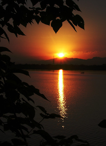
Colors of Sunset
Post Sunset shot of Hingol National Park
Fact Sheet:
Geographical Location:
25*30'N-65*30'E
Physical Location:
Makran coast, Baluchistan province. Approximately 190 km west of Karachi
Total Area:
610, 043 hectares
Date Established:
1988 and 1997 (includes Dhrun Wildlife Sanctuary)
Best Time to Visit:
Mid October to November and December to mid March
---------------------------------------------------------------------------
Description
Hingol National Park (HNP) ? the largest National Park in Pakistan covers about 610,043 It and lies on the Makran coast approximately 190 kilometers (km) from Karachi. The area was declared reserved in 1988 for the first time. The park area includes parts of the three districts of Balochistan; Lasbela, Gawader and Owaran, and contains a variety of topographical features and vegetation. Large tracts of the HNP are covered with drift sand and can be classified as coastal semi desert. HNP includes the estuary of the Hingol river which supports a significant diversity of bird and fish species.
Wildlife:
In addition to a variety of bird species, Hingol is also known to support threatened invertebrates. The park is reported to be an excellent habitat to wild animals including over 3,000 ibexes, and 1500 Urials and more than 1,200 Chinkara, besides number of resident and migratory birds. The Houbara Bustard (Chlamydotis undulata), Dalmatian and Spot-billed Pelican (Pelecanus philippensis) are regular visitors to the area.
The River Hingol has been nurturing crocodiles for centuries. The Marsh Crocodile (Crocodylus palustris), Olive Ridley (Lepidochelys olivacea) and Green Marine Turtles (Cheloniamydas), endemic and threatened species of fish, such as the Mahasheer occur and schools of Plumbeous Dolphins (Sousa plumbea) are known from close in-shore areas.
Mammals:
The park has a relative high diversity of species for this type of desert environment. However, the population of a number of species is critically low including for Wolf, Leopard, Hyena, and possibly of Caracal and Honey Badger. Populations of Chinkara are common in the Harian Valley and the Northern Plains but vulnerable. The most recent sightings of wolf are from a few years back and no recent sightings have been obtained to confirm the survival of the Desert Wolf in the park. The population is either critically low or the last individuals have been recently killed.
The status of the following species needs to be studied in more detail to assess their survival changes, their current distribution within the park and the population densities: Urial, Chinkara, Desert Wolf, Leopard, Caracal, Hyena, Wild Boar, Honey Badger.
The park has large populations of Ibex, although population like those of many other species were decimated during the long period of extreme drought (1998-2004). Porcupine is abundant in many locations both in the lowland valley and the Mountain plateaux. It is reportedly increasing in numbers in several areas. The main reason is likely the local loss of predators such as Leopard, Hyena and Desert Wolf. Cape Hare is numerous in many valleys and flood plain areas, and so are their main predators the Foxes and Jackal. Certain rodent species in particular Mouse like Hamster and Indian Gerbil may be quite common.
Birds:
The total number of species thus far listed for Hingol National Park is 185 (Nov 2006). The Species Diversity of the Park is relatively high for a desert area due to the large variety of habitats including sea, sea coast, estuaries and mudflats, riverine habitat and mountains up to 1580 m. The highest number of species is found at the seacoast, the estuary and along the Hingol River and main tributaries the Nal, Parken, Arra and Babro-Mari River. Some 45% or almost nearly half of all species are related to water including the seacoast, the estuary, and the Hingol River areas. The major groups among these are the seagull and terns, the pelicans, flamingos, herons and egrets, the plovers and lapwings and the stints, sandpipers, godwits, shanks, coots, curlews, king fishers, Osprey, etc..
Only a small number or about 10 % are typically related to the desert areas. Bird diversity is typically low in the tree-poor and degraded broad valleys and the desert areas with very limited water sources. The typical desert related bird groups include the Wheat-ears, Common Babblers, Larks, Sand Grouses, Partridges, the Houbara Bustard, some Shrikes and Buntings.
Many other species use the desert area also including many birds of prey, insect eating birds such as Bee-eaters, Hoopoes, and seed eaters such as Pigeons and Doves, and birds with a more varied diet such as White-eared Bulbuls, Sparrows and the Brown-headed Raven and Shrikes.
The remainder of the birds some 45% consists of birds of prey (Eagles, Vultures, Hawks, Buzzards, Falcons), pigeons, owls, nightyars, woodpeckers, rollers, swallows, martins, wagtails, chats, robins, warblers, white-throats, flycatchers, sunbird, drongo, mynas, sparrows, buntings.
Bird biomass is low, except at the estuary and mudflats and tidal river where large groups of Pelicans, Flamingos, Waders (Plovers, Stints, Sandpipers, Shanks), Seagulls, Terns, and Ducks like to congregate.
Some bird species profit from the influence of cultivation, in particular culture following species such as House Sparrows, Silverbells, White-eared Bulbuls, Buntings, Common Babblers, White throats and Brown-headed Raven. The water harvesting systems result in agricultural areas with high trees of Kand Prosopis glandiflora, Kikar Acacia nilotica, and Ber Zizyphus mauritiana. In particular Ziziphus mauritiana attracts fruit-seed eating birds such as White-eared Bulbul, Lesser White-throats, House Sparrows and others. They also provide nesting sites for many bird species. Blossoms and fruits of trees such as Salvadora spp. and Capparis decidua, usually attract several bird species, including the Purple Sunbirds Nectarinia asiatica. These trees are however scarce and may have much decreased in numbers through cutting for construction wood and fuel wood.
The fields with ripening grains such as millet attract many seed eating birds including rock pigeons, doves, buntings, sparrows and others.
Several species find either their eastern limit or their western limit in the Hingol and surroundings. A typical example is the Brown-headed Raven.
The Brown-headed Raven Corvus rufficollis is a restricted range species. It is limited to the southern areas of Balochistan, Iran up to Oman and Egypt. The eastern limits of its total range are at the east boundary of the park, while a few individuals wandering up to Liari and the estuary of the Porali River. They occur all over the park beyond its northern boundaries.
Groups of some 4 ?20 or more birds are found along each river and in each major valley. The Aghore group is the largest with more than 20 individuals. The total number of groups resident in the Park is estimated at 10-20 only.
A rare bird noted as limited range species with breeding in Balochistan coastal zone is the Sooty Falcon. It is regularly seen in Hingol and a group of 17 were sighted at Machi / Sangal mountain ridge and may be breeding in Hingol
At least half of the species listed for the park are migratory birds. The Park is part of the ?Asian Flyway? used by birds from Siberia and Central Asia to migrate to the flood plains, lakes and sea coastal areas of Pakistan, India up to Bangladesh. Some birds migrate to East Africa crossing the Arabian Sea. A small number of birds show altitudinal migration over shorter distances. They come down from the higher altitudes within Pakistan to migrate to non-snow covered and warmer areas (e.g., Orphean Whitethroat). The number of species and number of individuals is therefore much higher in the winter period. Most species can be noted when migratory species pass through during the arrival-passage time in autumn (Aug-Nov) and their return in spring (Feb-May). A small number of species stay the whole winter in the park area, notably some Egrets and Herons. A very small number migrates from south east to northwest in summer times.
The largest concentrations of migratory birds can be found at the Hingol estuary and lower Hingol River plains. Several birds of Prey pass through the coastal area during the wintertime. A two day survey in Jan. 2006, listed 150 Great White Pelicans, 40 Spot-billed and 50 Dalmatian Pelicans, 18 Great Cormorants, 400 Little Cormorants, 75 Western Reef Egrets, 200 Little Egrets, a few Intermediate, Great Egrets and Purple Heron, and 32 Grey Heron, 16 Black Ibis, and 200 Spoonbils. Ducks were limited to Eurasian Wigeon (800), Gadwall (150), Common Teal (600), and Northern Shoveler (200), the total number of shorebirds-waders amounted to 16 out of 40 species including amongst others Great Stone Plover (2), Whimbrel (60) and Eurasian Curlew (35). The Gull-Terns were represented with 12 out of 20 species with high numbers of Herring Gull (2000), and Black-headed Gull (1400).
Reptiles:
The Marsh Crocodile, Olive Ridley and Green Marine Turtles, Desert Monitor lizard, Yellow Monitor lizard, and different species of lizard and chameleon.
Source:
www.wildlifeofpakistan.com
www.unep-wcmc.org
Shot taken in HNP during a Widlife Survey of the Park:
Photo by NotMicroButSoft (CJ Restored Finally - Congrats)
30 of 36
Post Sunset Scene
After sun has set in Hingol National Park
Fact Sheet:
Geographical Location:
25*30'N-65*30'E
Physical Location:
Makran coast, Baluchistan province. Approximately 190 km west of Karachi
Total Area:
610, 043 hectares
Date Established:
1988 and 1997 (includes Dhrun Wildlife Sanctuary)
Best Time to Visit:
Mid October to November and December to mid March
---------------------------------------------------------------------------
Description
Hingol National Park (HNP) ? the largest National Park in Pakistan covers about 610,043 It and lies on the Makran coast approximately 190 kilometers (km) from Karachi. The area was declared reserved in 1988 for the first time. The park area includes parts of the three districts of Balochistan; Lasbela, Gawader and Owaran, and contains a variety of topographical features and vegetation. Large tracts of the HNP are covered with drift sand and can be classified as coastal semi desert. HNP includes the estuary of the Hingol river which supports a significant diversity of bird and fish species.
Wildlife:
In addition to a variety of bird species, Hingol is also known to support threatened invertebrates. The park is reported to be an excellent habitat to wild animals including over 3,000 ibexes, and 1500 Urials and more than 1,200 Chinkara, besides number of resident and migratory birds. The Houbara Bustard (Chlamydotis undulata), Dalmatian and Spot-billed Pelican (Pelecanus philippensis) are regular visitors to the area.
The River Hingol has been nurturing crocodiles for centuries. The Marsh Crocodile (Crocodylus palustris), Olive Ridley (Lepidochelys olivacea) and Green Marine Turtles (Cheloniamydas), endemic and threatened species of fish, such as the Mahasheer occur and schools of Plumbeous Dolphins (Sousa plumbea) are known from close in-shore areas.
Mammals:
The park has a relative high diversity of species for this type of desert environment. However, the population of a number of species is critically low including for Wolf, Leopard, Hyena, and possibly of Caracal and Honey Badger. Populations of Chinkara are common in the Harian Valley and the Northern Plains but vulnerable. The most recent sightings of wolf are from a few years back and no recent sightings have been obtained to confirm the survival of the Desert Wolf in the park. The population is either critically low or the last individuals have been recently killed.
The status of the following species needs to be studied in more detail to assess their survival changes, their current distribution within the park and the population densities: Urial, Chinkara, Desert Wolf, Leopard, Caracal, Hyena, Wild Boar, Honey Badger.
The park has large populations of Ibex, although population like those of many other species were decimated during the long period of extreme drought (1998-2004). Porcupine is abundant in many locations both in the lowland valley and the Mountain plateaux. It is reportedly increasing in numbers in several areas. The main reason is likely the local loss of predators such as Leopard, Hyena and Desert Wolf. Cape Hare is numerous in many valleys and flood plain areas, and so are their main predators the Foxes and Jackal. Certain rodent species in particular Mouse like Hamster and Indian Gerbil may be quite common.
Birds:
The total number of species thus far listed for Hingol National Park is 185 (Nov 2006). The Species Diversity of the Park is relatively high for a desert area due to the large variety of habitats including sea, sea coast, estuaries and mudflats, riverine habitat and mountains up to 1580 m. The highest number of species is found at the seacoast, the estuary and along the Hingol River and main tributaries the Nal, Parken, Arra and Babro-Mari River. Some 45% or almost nearly half of all species are related to water including the seacoast, the estuary, and the Hingol River areas. The major groups among these are the seagull and terns, the pelicans, flamingos, herons and egrets, the plovers and lapwings and the stints, sandpipers, godwits, shanks, coots, curlews, king fishers, Osprey, etc..
Only a small number or about 10 % are typically related to the desert areas. Bird diversity is typically low in the tree-poor and degraded broad valleys and the desert areas with very limited water sources. The typical desert related bird groups include the Wheat-ears, Common Babblers, Larks, Sand Grouses, Partridges, the Houbara Bustard, some Shrikes and Buntings.
Many other species use the desert area also including many birds of prey, insect eating birds such as Bee-eaters, Hoopoes, and seed eaters such as Pigeons and Doves, and birds with a more varied diet such as White-eared Bulbuls, Sparrows and the Brown-headed Raven and Shrikes.
The remainder of the birds some 45% consists of birds of prey (Eagles, Vultures, Hawks, Buzzards, Falcons), pigeons, owls, nightyars, woodpeckers, rollers, swallows, martins, wagtails, chats, robins, warblers, white-throats, flycatchers, sunbird, drongo, mynas, sparrows, buntings.
Bird biomass is low, except at the estuary and mudflats and tidal river where large groups of Pelicans, Flamingos, Waders (Plovers, Stints, Sandpipers, Shanks), Seagulls, Terns, and Ducks like to congregate.
Some bird species profit from the influence of cultivation, in particular culture following species such as House Sparrows, Silverbells, White-eared Bulbuls, Buntings, Common Babblers, White throats and Brown-headed Raven. The water harvesting systems result in agricultural areas with high trees of Kand Prosopis glandiflora, Kikar Acacia nilotica, and Ber Zizyphus mauritiana. In particular Ziziphus mauritiana attracts fruit-seed eating birds such as White-eared Bulbul, Lesser White-throats, House Sparrows and others. They also provide nesting sites for many bird species. Blossoms and fruits of trees such as Salvadora spp. and Capparis decidua, usually attract several bird species, including the Purple Sunbirds Nectarinia asiatica. These trees are however scarce and may have much decreased in numbers through cutting for construction wood and fuel wood.
The fields with ripening grains such as millet attract many seed eating birds including rock pigeons, doves, buntings, sparrows and others.
Several species find either their eastern limit or their western limit in the Hingol and surroundings. A typical example is the Brown-headed Raven.
The Brown-headed Raven Corvus rufficollis is a restricted range species. It is limited to the southern areas of Balochistan, Iran up to Oman and Egypt. The eastern limits of its total range are at the east boundary of the park, while a few individuals wandering up to Liari and the estuary of the Porali River. They occur all over the park beyond its northern boundaries.
Groups of some 4 ?20 or more birds are found along each river and in each major valley. The Aghore group is the largest with more than 20 individuals. The total number of groups resident in the Park is estimated at 10-20 only.
A rare bird noted as limited range species with breeding in Balochistan coastal zone is the Sooty Falcon. It is regularly seen in Hingol and a group of 17 were sighted at Machi / Sangal mountain ridge and may be breeding in Hingol
At least half of the species listed for the park are migratory birds. The Park is part of the ?Asian Flyway? used by birds from Siberia and Central Asia to migrate to the flood plains, lakes and sea coastal areas of Pakistan, India up to Bangladesh. Some birds migrate to East Africa crossing the Arabian Sea. A small number of birds show altitudinal migration over shorter distances. They come down from the higher altitudes within Pakistan to migrate to non-snow covered and warmer areas (e.g., Orphean Whitethroat). The number of species and number of individuals is therefore much higher in the winter period. Most species can be noted when migratory species pass through during the arrival-passage time in autumn (Aug-Nov) and their return in spring (Feb-May). A small number of species stay the whole winter in the park area, notably some Egrets and Herons. A very small number migrates from south east to northwest in summer times.
The largest concentrations of migratory birds can be found at the Hingol estuary and lower Hingol River plains. Several birds of Prey pass through the coastal area during the wintertime. A two day survey in Jan. 2006, listed 150 Great White Pelicans, 40 Spot-billed and 50 Dalmatian Pelicans, 18 Great Cormorants, 400 Little Cormorants, 75 Western Reef Egrets, 200 Little Egrets, a few Intermediate, Great Egrets and Purple Heron, and 32 Grey Heron, 16 Black Ibis, and 200 Spoonbils. Ducks were limited to Eurasian Wigeon (800), Gadwall (150), Common Teal (600), and Northern Shoveler (200), the total number of shorebirds-waders amounted to 16 out of 40 species including amongst others Great Stone Plover (2), Whimbrel (60) and Eurasian Curlew (35). The Gull-Terns were represented with 12 out of 20 species with high numbers of Herring Gull (2000), and Black-headed Gull (1400).
Reptiles:
The Marsh Crocodile, Olive Ridley and Green Marine Turtles, Desert Monitor lizard, Yellow Monitor lizard, and different species of lizard and chameleon.
Source:
www.wildlifeofpakistan.com
www.unep-wcmc.org
Unpubished Report on Wildlife of Hingol National Park
Shot taken in HNP during a Widlife Survey of the Park:
Photo by NotMicroButSoft (CJ Restored Finally - Congrats)
31 of 36
Home Alone
An isolated house in Hingol National Park Area
Fact Sheet:
Geographical Location:
25*30'N-65*30'E
Physical Location:
Makran coast, Baluchistan province. Approximately 190 km west of Karachi
Total Area:
610, 043 hectares
Date Established:
1988 and 1997 (includes Dhrun Wildlife Sanctuary)
Best Time to Visit:
Mid October to November and December to mid March
---------------------------------------------------------------------------
Description
Hingol National Park (HNP) ? the largest National Park in Pakistan covers about 610,043 It and lies on the Makran coast approximately 190 kilometers (km) from Karachi. The area was declared reserved in 1988 for the first time. The park area includes parts of the three districts of Balochistan; Lasbela, Gawader and Owaran, and contains a variety of topographical features and vegetation. Large tracts of the HNP are covered with drift sand and can be classified as coastal semi desert. HNP includes the estuary of the Hingol river which supports a significant diversity of bird and fish species.
Wildlife:
In addition to a variety of bird species, Hingol is also known to support threatened invertebrates. The park is reported to be an excellent habitat to wild animals including over 3,000 ibexes, and 1500 Urials and more than 1,200 Chinkara, besides number of resident and migratory birds. The Houbara Bustard (Chlamydotis undulata), Dalmatian and Spot-billed Pelican (Pelecanus philippensis) are regular visitors to the area.
The River Hingol has been nurturing crocodiles for centuries. The Marsh Crocodile (Crocodylus palustris), Olive Ridley (Lepidochelys olivacea) and Green Marine Turtles (Cheloniamydas), endemic and threatened species of fish, such as the Mahasheer occur and schools of Plumbeous Dolphins (Sousa plumbea) are known from close in-shore areas.
Mammals:
The park has a relative high diversity of species for this type of desert environment. However, the population of a number of species is critically low including for Wolf, Leopard, Hyena, and possibly of Caracal and Honey Badger. Populations of Chinkara are common in the Harian Valley and the Northern Plains but vulnerable. The most recent sightings of wolf are from a few years back and no recent sightings have been obtained to confirm the survival of the Desert Wolf in the park. The population is either critically low or the last individuals have been recently killed.
The status of the following species needs to be studied in more detail to assess their survival changes, their current distribution within the park and the population densities: Urial, Chinkara, Desert Wolf, Leopard, Caracal, Hyena, Wild Boar, Honey Badger.
The park has large populations of Ibex, although population like those of many other species were decimated during the long period of extreme drought (1998-2004). Porcupine is abundant in many locations both in the lowland valley and the Mountain plateaux. It is reportedly increasing in numbers in several areas. The main reason is likely the local loss of predators such as Leopard, Hyena and Desert Wolf. Cape Hare is numerous in many valleys and flood plain areas, and so are their main predators the Foxes and Jackal. Certain rodent species in particular Mouse like Hamster and Indian Gerbil may be quite common.
Birds:
The total number of species thus far listed for Hingol National Park is 185 (Nov 2006). The Species Diversity of the Park is relatively high for a desert area due to the large variety of habitats including sea, sea coast, estuaries and mudflats, riverine habitat and mountains up to 1580 m. The highest number of species is found at the seacoast, the estuary and along the Hingol River and main tributaries the Nal, Parken, Arra and Babro-Mari River. Some 45% or almost nearly half of all species are related to water including the seacoast, the estuary, and the Hingol River areas. The major groups among these are the seagull and terns, the pelicans, flamingos, herons and egrets, the plovers and lapwings and the stints, sandpipers, godwits, shanks, coots, curlews, king fishers, Osprey, etc..
Only a small number or about 10 % are typically related to the desert areas. Bird diversity is typically low in the tree-poor and degraded broad valleys and the desert areas with very limited water sources. The typical desert related bird groups include the Wheat-ears, Common Babblers, Larks, Sand Grouses, Partridges, the Houbara Bustard, some Shrikes and Buntings.
Many other species use the desert area also including many birds of prey, insect eating birds such as Bee-eaters, Hoopoes, and seed eaters such as Pigeons and Doves, and birds with a more varied diet such as White-eared Bulbuls, Sparrows and the Brown-headed Raven and Shrikes.
The remainder of the birds some 45% consists of birds of prey (Eagles, Vultures, Hawks, Buzzards, Falcons), pigeons, owls, nightyars, woodpeckers, rollers, swallows, martins, wagtails, chats, robins, warblers, white-throats, flycatchers, sunbird, drongo, mynas, sparrows, buntings.
Bird biomass is low, except at the estuary and mudflats and tidal river where large groups of Pelicans, Flamingos, Waders (Plovers, Stints, Sandpipers, Shanks), Seagulls, Terns, and Ducks like to congregate.
Some bird species profit from the influence of cultivation, in particular culture following species such as House Sparrows, Silverbells, White-eared Bulbuls, Buntings, Common Babblers, White throats and Brown-headed Raven. The water harvesting systems result in agricultural areas with high trees of Kand Prosopis glandiflora, Kikar Acacia nilotica, and Ber Zizyphus mauritiana. In particular Ziziphus mauritiana attracts fruit-seed eating birds such as White-eared Bulbul, Lesser White-throats, House Sparrows and others. They also provide nesting sites for many bird species. Blossoms and fruits of trees such as Salvadora spp. and Capparis decidua, usually attract several bird species, including the Purple Sunbirds Nectarinia asiatica. These trees are however scarce and may have much decreased in numbers through cutting for construction wood and fuel wood.
The fields with ripening grains such as millet attract many seed eating birds including rock pigeons, doves, buntings, sparrows and others.
Several species find either their eastern limit or their western limit in the Hingol and surroundings. A typical example is the Brown-headed Raven.
The Brown-headed Raven Corvus rufficollis is a restricted range species. It is limited to the southern areas of Balochistan, Iran up to Oman and Egypt. The eastern limits of its total range are at the east boundary of the park, while a few individuals wandering up to Liari and the estuary of the Porali River. They occur all over the park beyond its northern boundaries.
Groups of some 4 ?20 or more birds are found along each river and in each major valley. The Aghore group is the largest with more than 20 individuals. The total number of groups resident in the Park is estimated at 10-20 only.
A rare bird noted as limited range species with breeding in Balochistan coastal zone is the Sooty Falcon. It is regularly seen in Hingol and a group of 17 were sighted at Machi / Sangal mountain ridge and may be breeding in Hingol
At least half of the species listed for the park are migratory birds. The Park is part of the ?Asian Flyway? used by birds from Siberia and Central Asia to migrate to the flood plains, lakes and sea coastal areas of Pakistan, India up to Bangladesh. Some birds migrate to East Africa crossing the Arabian Sea. A small number of birds show altitudinal migration over shorter distances. They come down from the higher altitudes within Pakistan to migrate to non-snow covered and warmer areas (e.g., Orphean Whitethroat). The number of species and number of individuals is therefore much higher in the winter period. Most species can be noted when migratory species pass through during the arrival-passage time in autumn (Aug-Nov) and their return in spring (Feb-May). A small number of species stay the whole winter in the park area, notably some Egrets and Herons. A very small number migrates from south east to northwest in summer times.
The largest concentrations of migratory birds can be found at the Hingol estuary and lower Hingol River plains. Several birds of Prey pass through the coastal area during the wintertime. A two day survey in Jan. 2006, listed 150 Great White Pelicans, 40 Spot-billed and 50 Dalmatian Pelicans, 18 Great Cormorants, 400 Little Cormorants, 75 Western Reef Egrets, 200 Little Egrets, a few Intermediate, Great Egrets and Purple Heron, and 32 Grey Heron, 16 Black Ibis, and 200 Spoonbils. Ducks were limited to Eurasian Wigeon (800), Gadwall (150), Common Teal (600), and Northern Shoveler (200), the total number of shorebirds-waders amounted to 16 out of 40 species including amongst others Great Stone Plover (2), Whimbrel (60) and Eurasian Curlew (35). The Gull-Terns were represented with 12 out of 20 species with high numbers of Herring Gull (2000), and Black-headed Gull (1400).
Reptiles:
The Marsh Crocodile, Olive Ridley and Green Marine Turtles, Desert Monitor lizard, Yellow Monitor lizard, and different species of lizard and chameleon.
Source:
www.wildlifeofpakistan.com
www.unep-wcmc.org
Shot taken in HNP during a Widlife Survey of the Park:
Photo by NotMicroButSoft (CJ Restored Finally - Congrats)
32 of 36
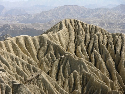
Mud Mountain
Mud Moutain of Hingol National Park
Fact Sheet:
Geographical Location:
25*30'N-65*30'E
Physical Location:
Makran coast, Baluchistan province. Approximately 190 km west of Karachi
Total Area:
610, 043 hectares
Date Established:
1988 and 1997 (includes Dhrun Wildlife Sanctuary)
Best Time to Visit:
Mid October to November and December to mid March
---------------------------------------------------------------------------
Description
Hingol National Park (HNP) ? the largest National Park in Pakistan covers about 610,043 It and lies on the Makran coast approximately 190 kilometers (km) from Karachi. The area was declared reserved in 1988 for the first time. The park area includes parts of the three districts of Balochistan; Lasbela, Gawader and Owaran, and contains a variety of topographical features and vegetation. Large tracts of the HNP are covered with drift sand and can be classified as coastal semi desert. HNP includes the estuary of the Hingol river which supports a significant diversity of bird and fish species.
Wildlife:
In addition to a variety of bird species, Hingol is also known to support threatened invertebrates. The park is reported to be an excellent habitat to wild animals including over 3,000 ibexes, and 1500 Urials and more than 1,200 Chinkara, besides number of resident and migratory birds. The Houbara Bustard (Chlamydotis undulata), Dalmatian and Spot-billed Pelican (Pelecanus philippensis) are regular visitors to the area.
The River Hingol has been nurturing crocodiles for centuries. The Marsh Crocodile (Crocodylus palustris), Olive Ridley (Lepidochelys olivacea) and Green Marine Turtles (Cheloniamydas), endemic and threatened species of fish, such as the Mahasheer occur and schools of Plumbeous Dolphins (Sousa plumbea) are known from close in-shore areas.
Mammals:
The park has a relative high diversity of species for this type of desert environment. However, the population of a number of species is critically low including for Wolf, Leopard, Hyena, and possibly of Caracal and Honey Badger. Populations of Chinkara are common in the Harian Valley and the Northern Plains but vulnerable. The most recent sightings of wolf are from a few years back and no recent sightings have been obtained to confirm the survival of the Desert Wolf in the park. The population is either critically low or the last individuals have been recently killed.
The status of the following species needs to be studied in more detail to assess their survival changes, their current distribution within the park and the population densities: Urial, Chinkara, Desert Wolf, Leopard, Caracal, Hyena, Wild Boar, Honey Badger.
The park has large populations of Ibex, although population like those of many other species were decimated during the long period of extreme drought (1998-2004). Porcupine is abundant in many locations both in the lowland valley and the Mountain plateaux. It is reportedly increasing in numbers in several areas. The main reason is likely the local loss of predators such as Leopard, Hyena and Desert Wolf. Cape Hare is numerous in many valleys and flood plain areas, and so are their main predators the Foxes and Jackal. Certain rodent species in particular Mouse like Hamster and Indian Gerbil may be quite common.
Birds:
The total number of species thus far listed for Hingol National Park is 185 (Nov 2006). The Species Diversity of the Park is relatively high for a desert area due to the large variety of habitats including sea, sea coast, estuaries and mudflats, riverine habitat and mountains up to 1580 m. The highest number of species is found at the seacoast, the estuary and along the Hingol River and main tributaries the Nal, Parken, Arra and Babro-Mari River. Some 45% or almost nearly half of all species are related to water including the seacoast, the estuary, and the Hingol River areas. The major groups among these are the seagull and terns, the pelicans, flamingos, herons and egrets, the plovers and lapwings and the stints, sandpipers, godwits, shanks, coots, curlews, king fishers, Osprey, etc..
Only a small number or about 10 % are typically related to the desert areas. Bird diversity is typically low in the tree-poor and degraded broad valleys and the desert areas with very limited water sources. The typical desert related bird groups include the Wheat-ears, Common Babblers, Larks, Sand Grouses, Partridges, the Houbara Bustard, some Shrikes and Buntings.
Many other species use the desert area also including many birds of prey, insect eating birds such as Bee-eaters, Hoopoes, and seed eaters such as Pigeons and Doves, and birds with a more varied diet such as White-eared Bulbuls, Sparrows and the Brown-headed Raven and Shrikes.
The remainder of the birds some 45% consists of birds of prey (Eagles, Vultures, Hawks, Buzzards, Falcons), pigeons, owls, nightyars, woodpeckers, rollers, swallows, martins, wagtails, chats, robins, warblers, white-throats, flycatchers, sunbird, drongo, mynas, sparrows, buntings.
Bird biomass is low, except at the estuary and mudflats and tidal river where large groups of Pelicans, Flamingos, Waders (Plovers, Stints, Sandpipers, Shanks), Seagulls, Terns, and Ducks like to congregate.
Some bird species profit from the influence of cultivation, in particular culture following species such as House Sparrows, Silverbells, White-eared Bulbuls, Buntings, Common Babblers, White throats and Brown-headed Raven. The water harvesting systems result in agricultural areas with high trees of Kand Prosopis glandiflora, Kikar Acacia nilotica, and Ber Zizyphus mauritiana. In particular Ziziphus mauritiana attracts fruit-seed eating birds such as White-eared Bulbul, Lesser White-throats, House Sparrows and others. They also provide nesting sites for many bird species. Blossoms and fruits of trees such as Salvadora spp. and Capparis decidua, usually attract several bird species, including the Purple Sunbirds Nectarinia asiatica. These trees are however scarce and may have much decreased in numbers through cutting for construction wood and fuel wood.
The fields with ripening grains such as millet attract many seed eating birds including rock pigeons, doves, buntings, sparrows and others.
Several species find either their eastern limit or their western limit in the Hingol and surroundings. A typical example is the Brown-headed Raven.
The Brown-headed Raven Corvus rufficollis is a restricted range species. It is limited to the southern areas of Balochistan, Iran up to Oman and Egypt. The eastern limits of its total range are at the east boundary of the park, while a few individuals wandering up to Liari and the estuary of the Porali River. They occur all over the park beyond its northern boundaries.
Groups of some 4 ?20 or more birds are found along each river and in each major valley. The Aghore group is the largest with more than 20 individuals. The total number of groups resident in the Park is estimated at 10-20 only.
A rare bird noted as limited range species with breeding in Balochistan coastal zone is the Sooty Falcon. It is regularly seen in Hingol and a group of 17 were sighted at Machi / Sangal mountain ridge and may be breeding in Hingol
At least half of the species listed for the park are migratory birds. The Park is part of the ?Asian Flyway? used by birds from Siberia and Central Asia to migrate to the flood plains, lakes and sea coastal areas of Pakistan, India up to Bangladesh. Some birds migrate to East Africa crossing the Arabian Sea. A small number of birds show altitudinal migration over shorter distances. They come down from the higher altitudes within Pakistan to migrate to non-snow covered and warmer areas (e.g., Orphean Whitethroat). The number of species and number of individuals is therefore much higher in the winter period. Most species can be noted when migratory species pass through during the arrival-passage time in autumn (Aug-Nov) and their return in spring (Feb-May). A small number of species stay the whole winter in the park area, notably some Egrets and Herons. A very small number migrates from south east to northwest in summer times.
The largest concentrations of migratory birds can be found at the Hingol estuary and lower Hingol River plains. Several birds of Prey pass through the coastal area during the wintertime. A two day survey in Jan. 2006, listed 150 Great White Pelicans, 40 Spot-billed and 50 Dalmatian Pelicans, 18 Great Cormorants, 400 Little Cormorants, 75 Western Reef Egrets, 200 Little Egrets, a few Intermediate, Great Egrets and Purple Heron, and 32 Grey Heron, 16 Black Ibis, and 200 Spoonbils. Ducks were limited to Eurasian Wigeon (800), Gadwall (150), Common Teal (600), and Northern Shoveler (200), the total number of shorebirds-waders amounted to 16 out of 40 species including amongst others Great Stone Plover (2), Whimbrel (60) and Eurasian Curlew (35). The Gull-Terns were represented with 12 out of 20 species with high numbers of Herring Gull (2000), and Black-headed Gull (1400).
Reptiles:
The Marsh Crocodile, Olive Ridley and Green Marine Turtles, Desert Monitor lizard, Yellow Monitor lizard, and different species of lizard and chameleon.
Source:
www.wildlifeofpakistan.com
www.unep-wcmc.org
Shot taken in HNP during a Widlife Survey of the Park:
Photo by NotMicroButSoft (CJ Restored Finally - Congrats)
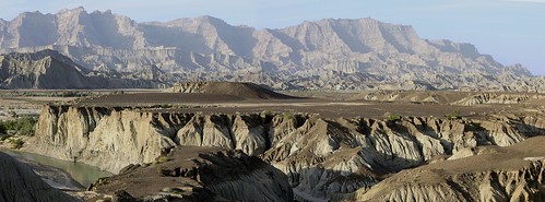
33 of 36
Hingol National Park
A panoramic view of Hingol National Park
Fact Sheet:
Geographical Location:
25*30'N-65*30'E
Physical Location:
Makran coast, Baluchistan province. Approximately 190 km west of Karachi
Total Area:
610, 043 hectares
Date Established:
1988 and 1997 (includes Dhrun Wildlife Sanctuary)
Best Time to Visit:
Mid October to November and December to mid March
---------------------------------------------------------------------------
Description
Hingol National Park (HNP) ? the largest National Park in Pakistan covers about 610,043 It and lies on the Makran coast approximately 190 kilometers (km) from Karachi. The area was declared reserved in 1988 for the first time. The park area includes parts of the three districts of Balochistan; Lasbela, Gawader and Owaran, and contains a variety of topographical features and vegetation. Large tracts of the HNP are covered with drift sand and can be classified as coastal semi desert. HNP includes the estuary of the Hingol river which supports a significant diversity of bird and fish species.
Wildlife:
In addition to a variety of bird species, Hingol is also known to support threatened invertebrates. The park is reported to be an excellent habitat to wild animals including over 3,000 ibexes, and 1500 Urials and more than 1,200 Chinkara, besides number of resident and migratory birds. The Houbara Bustard (Chlamydotis undulata), Dalmatian and Spot-billed Pelican (Pelecanus philippensis) are regular visitors to the area.
The River Hingol has been nurturing crocodiles for centuries. The Marsh Crocodile (Crocodylus palustris), Olive Ridley (Lepidochelys olivacea) and Green Marine Turtles (Cheloniamydas), endemic and threatened species of fish, such as the Mahasheer occur and schools of Plumbeous Dolphins (Sousa plumbea) are known from close in-shore areas.
Mammals:
The park has a relative high diversity of species for this type of desert environment. However, the population of a number of species is critically low including for Wolf, Leopard, Hyena, and possibly of Caracal and Honey Badger. Populations of Chinkara are common in the Harian Valley and the Northern Plains but vulnerable. The most recent sightings of wolf are from a few years back and no recent sightings have been obtained to confirm the survival of the Desert Wolf in the park. The population is either critically low or the last individuals have been recently killed.
The status of the following species needs to be studied in more detail to assess their survival changes, their current distribution within the park and the population densities: Urial, Chinkara, Desert Wolf, Leopard, Caracal, Hyena, Wild Boar, Honey Badger.
The park has large populations of Ibex, although population like those of many other species were decimated during the long period of extreme drought (1998-2004). Porcupine is abundant in many locations both in the lowland valley and the Mountain plateaux. It is reportedly increasing in numbers in several areas. The main reason is likely the local loss of predators such as Leopard, Hyena and Desert Wolf. Cape Hare is numerous in many valleys and flood plain areas, and so are their main predators the Foxes and Jackal. Certain rodent species in particular Mouse like Hamster and Indian Gerbil may be quite common.
Birds:
The total number of species thus far listed for Hingol National Park is 185 (Nov 2006). The Species Diversity of the Park is relatively high for a desert area due to the large variety of habitats including sea, sea coast, estuaries and mudflats, riverine habitat and mountains up to 1580 m. The highest number of species is found at the seacoast, the estuary and along the Hingol River and main tributaries the Nal, Parken, Arra and Babro-Mari River. Some 45% or almost nearly half of all species are related to water including the seacoast, the estuary, and the Hingol River areas. The major groups among these are the seagull and terns, the pelicans, flamingos, herons and egrets, the plovers and lapwings and the stints, sandpipers, godwits, shanks, coots, curlews, king fishers, Osprey, etc..
Only a small number or about 10 % are typically related to the desert areas. Bird diversity is typically low in the tree-poor and degraded broad valleys and the desert areas with very limited water sources. The typical desert related bird groups include the Wheat-ears, Common Babblers, Larks, Sand Grouses, Partridges, the Houbara Bustard, some Shrikes and Buntings.
Many other species use the desert area also including many birds of prey, insect eating birds such as Bee-eaters, Hoopoes, and seed eaters such as Pigeons and Doves, and birds with a more varied diet such as White-eared Bulbuls, Sparrows and the Brown-headed Raven and Shrikes.
The remainder of the birds some 45% consists of birds of prey (Eagles, Vultures, Hawks, Buzzards, Falcons), pigeons, owls, nightyars, woodpeckers, rollers, swallows, martins, wagtails, chats, robins, warblers, white-throats, flycatchers, sunbird, drongo, mynas, sparrows, buntings.
Bird biomass is low, except at the estuary and mudflats and tidal river where large groups of Pelicans, Flamingos, Waders (Plovers, Stints, Sandpipers, Shanks), Seagulls, Terns, and Ducks like to congregate.
Some bird species profit from the influence of cultivation, in particular culture following species such as House Sparrows, Silverbells, White-eared Bulbuls, Buntings, Common Babblers, White throats and Brown-headed Raven. The water harvesting systems result in agricultural areas with high trees of Kand Prosopis glandiflora, Kikar Acacia nilotica, and Ber Zizyphus mauritiana. In particular Ziziphus mauritiana attracts fruit-seed eating birds such as White-eared Bulbul, Lesser White-throats, House Sparrows and others. They also provide nesting sites for many bird species. Blossoms and fruits of trees such as Salvadora spp. and Capparis decidua, usually attract several bird species, including the Purple Sunbirds Nectarinia asiatica. These trees are however scarce and may have much decreased in numbers through cutting for construction wood and fuel wood.
The fields with ripening grains such as millet attract many seed eating birds including rock pigeons, doves, buntings, sparrows and others.
Several species find either their eastern limit or their western limit in the Hingol and surroundings. A typical example is the Brown-headed Raven.
The Brown-headed Raven Corvus rufficollis is a restricted range species. It is limited to the southern areas of Balochistan, Iran up to Oman and Egypt. The eastern limits of its total range are at the east boundary of the park, while a few individuals wandering up to Liari and the estuary of the Porali River. They occur all over the park beyond its northern boundaries.
Groups of some 4 ?20 or more birds are found along each river and in each major valley. The Aghore group is the largest with more than 20 individuals. The total number of groups resident in the Park is estimated at 10-20 only.
A rare bird noted as limited range species with breeding in Balochistan coastal zone is the Sooty Falcon. It is regularly seen in Hingol and a group of 17 were sighted at Machi / Sangal mountain ridge and may be breeding in Hingol
At least half of the species listed for the park are migratory birds. The Park is part of the ?Asian Flyway? used by birds from Siberia and Central Asia to migrate to the flood plains, lakes and sea coastal areas of Pakistan, India up to Bangladesh. Some birds migrate to East Africa crossing the Arabian Sea. A small number of birds show altitudinal migration over shorter distances. They come down from the higher altitudes within Pakistan to migrate to non-snow covered and warmer areas (e.g., Orphean Whitethroat). The number of species and number of individuals is therefore much higher in the winter period. Most species can be noted when migratory species pass through during the arrival-passage time in autumn (Aug-Nov) and their return in spring (Feb-May). A small number of species stay the whole winter in the park area, notably some Egrets and Herons. A very small number migrates from south east to northwest in summer times.
The largest concentrations of migratory birds can be found at the Hingol estuary and lower Hingol River plains. Several birds of Prey pass through the coastal area during the wintertime. A two day survey in Jan. 2006, listed 150 Great White Pelicans, 40 Spot-billed and 50 Dalmatian Pelicans, 18 Great Cormorants, 400 Little Cormorants, 75 Western Reef Egrets, 200 Little Egrets, a few Intermediate, Great Egrets and Purple Heron, and 32 Grey Heron, 16 Black Ibis, and 200 Spoonbils. Ducks were limited to Eurasian Wigeon (800), Gadwall (150), Common Teal (600), and Northern Shoveler (200), the total number of shorebirds-waders amounted to 16 out of 40 species including amongst others Great Stone Plover (2), Whimbrel (60) and Eurasian Curlew (35). The Gull-Terns were represented with 12 out of 20 species with high numbers of Herring Gull (2000), and Black-headed Gull (1400).
Reptiles:
The Marsh Crocodile, Olive Ridley and Green Marine Turtles, Desert Monitor lizard, Yellow Monitor lizard, and different species of lizard and chameleon.
Source:
www.wildlifeofpakistan.com
www.unep-wcmc.org
Shot taken in HNP during a Widlife Survey of the Park:
Photo by NotMicroButSoft (CJ Restored Finally - Congrats)
34 of 36
Over Himalayas
A view taken near Chattar Class, from Helicopter while flying from Muzaffarabad to Islamabad
Photo by NotMicroButSoft (CJ Restored Finally - Congrats)
35 of 36
Looking Back to the History
The Khyber Pass (also called the Khaiber Pass or Khaybar Pass) (Urdu: ??? ????) is the most important pass connecting Pakistan with Afghanistan and it is also the National pass of the Pakistani nation. Throughout history it has been an important trade route between Central Asia and South Asia and a strategic military location. The actual pass summit is 5 km inside Pakistan at Landi Kotal. The pass cuts through the Safed Koh mountains which are a far southeastern extension of the Hindu Kush range.
Going northwest from the eastern end in Pakistan, the pass starts from near Jamrud (15 km west of Peshawar) and ends west of Torkham, Afghanistan, a winding road of 48 km. The route passes Fort Maude and Ali Masjid to reach the narrowest point of the pass, just 15 m wide. The summit is at Landi Kotal, followed by a steep decline to Michni Kandao, Landi Khana and the Afghan border just east of Torkham. Here the gradient becomes easier as the pass exits at Haft Chah onto the Dakka plain. From Dakka, the Kabul River flows back to Peshawar through the Loe Shilman Gorge, a less direct and more difficult route, but the one chosen by Alexander the Great when he crossed over into South Asia in 326 BC in an attempt to invade the Indus Valley.
Jamrud is at an elevation of 491 m (1610 feet), while the summit at Landi Kotal is 1070 m (3509 feet). The current road was built by the British through the Pass in 1879 and a railway in the 1920s (the previous railhead was at Jamrud).
In some versions of the Aryan migration theory, the Indo-Aryans migrated to India via the Khyber Pass. Recorded invasions through the Khyber Pass date from the time of Alexander the Great, with several Muslim invasions of South Asia, culminating with the establishment of the Mughul Empire from 1526. Going the other way, the British invaded Afghanistan through the Pass and fought three Afghan Wars in 1839-42, 1878-80, and 1919.
To the north of the Khyber Pass lies the country of the Mullagori Afridis. To the south is Afridi Tirah, while the inhabitants of villages in the Pass itself are Afridi clansmen. Throughout the centuries the Pashtun clans, particularly the Afridis and the Afghan Shinwaris, have regarded the Pass as their own preserve and have levied a toll on travellers for safe conduct. Since this form of extortion has always been their main source of income, they are naturally disturbed when anyone comes along to interfere with it. Hence their dislike of invading armies and penetrations, and other exercises of authority, even though some armies have been prepared to pay the blackmail, in the form of allowances. Resistance from the local tribesmen has always been fierce.
George Molesworth, a member of the British force of 1919, summarised it well. "Every stone in the Khaibar has been soaked in blood."
The area of the Khyber Pass has been connected with a counterfeit arms industry, making AK-47's and Martini-Henry rifles, among others, using local steel and blacksmiths' forges.
Source: en.wikipedia.org/wiki/Khyber_Pass
Photo by NotMicroButSoft (CJ Restored Finally - Congrats)
36 of 36
Koh-o-Darya wa gharoob-e-Aftaab ---------- Man khuda ra deedam Aanja Behijaab
Translation:
The mountain, the river, and the sunset
Here I see God's beauty totally unrevealed.
Sunset at Rawal Lake Islamabad.
Photo by NotMicroButSoft (CJ Restored Finally - Congrats)